ચિત્ર:LocationRomania.png
આથી વધુ ઘનત્વ ઉપલબ્ધ નથી.
LocationRomania.png (૨૫૦ × ૧૧૫ પીક્સલ, ફાઇલનું કદ: ૭ KB, MIME પ્રકાર: image/png)

|
This locator map image could be re-created using vector graphics as an SVG file. This has several advantages; see Commons:Media for cleanup for more information. If an SVG form of this image is available, please upload it and afterwards replace this template with
{{vector version available|new image name}}.
It is recommended to name the SVG file “LocationRomania.svg”—then the template Vector version available (or Vva) does not need the new image name parameter. |
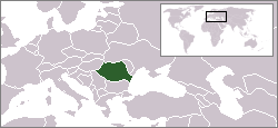
English: Location map of Romania.
Originally created for English Wikipedia by Vardion.
| |
આ રચના ના લેખક Vardion, at the અંગ્રેજી વિકિપીડિયા project દ્વારા આ રચનાને public domain હેઠળ પ્રકાશિત કરાઈ છે. આ સવલત વિશ્વવ્યપી છે In case this is not legally possible: |
ફાઇલનો ઇતિહાસ
તારીખ/સમય ઉપર ક્લિક કરવાથી તે સમયે ફાઇલ કેવી હતી તે જોવા મળશે.
| તારીખ/સમય | લઘુચિત્ર | પરિમાણો | સભ્ય | ટિપ્પણી | |
|---|---|---|---|---|---|
| વર્તમાન | ૦૨:૧૫, ૩ એપ્રિલ ૨૦૦૯ | | ૨૫૦ × ૧૧૫ (૭ KB) | D.h | Reverted to version as of 20:37, 2 April 2009 |
| ૦૨:૦૭, ૩ એપ્રિલ ૨૦૦૯ |  | ૨૫૦ × ૧૧૫ (૬ KB) | D.h | Reverted to version as of 23:25, 6 July 2007 | |
| ૦૨:૦૭, ૩ એપ્રિલ ૨૦૦૯ |  | ૨૫૦ × ૧૧૫ (૭ KB) | D.h | Reverted to version as of 20:22, 8 September 2007 | |
| ૦૭:૩૨, ૧ માર્ચ ૨૦૦૯ |  | ૧,૬૦૦ × ૧,૨૦૦ (૪૭૦ KB) | Olahus | Romania in EU | |
| ૦૧:૫૨, ૯ સપ્ટેમ્બર ૨૦૦૭ |  | ૨૫૦ × ૧૧૫ (૭ KB) | Skatefreak | Reverted to version as of 11:48, 4 June 2006 | |
| ૦૪:૫૫, ૭ જુલાઇ ૨૦૦૭ |  | ૨૫૦ × ૧૧૫ (૬ KB) | Dove | Location of the Romania {{GFDL}} Category:Locator maps for former territories | |
| ૧૭:૧૮, ૪ જૂન ૨૦૦૬ |  | ૨૫૦ × ૧૧૫ (૭ KB) | Rain74 | added Serbia-Montenegro border | |
| ૨૦:૩૮, ૯ ડિસેમ્બર ૨૦૦૪ |  | ૨૫૦ × ૧૧૫ (૭ KB) | EugeneZelenko | Location map for the Romania.<br/>Originally created for English Wikipedia by Vardion.<br/>{{PD}}<br/>Category:Country locator maps |
ફાઇલનો વપરાશ
આ ફાઇલ માં નીચેનું પાનું વપરાયેલું છે:
ફાઇલનો વ્યાપક ઉપયોગ
નીચેની બીજી વિકિઓ આ ફાઈલ વાપરે છે:
- arc.wikipedia.org પર વપરાશ
- av.wikipedia.org પર વપરાશ
- bg.wikipedia.org પર વપરાશ
- bo.wikipedia.org પર વપરાશ
- bpy.wikipedia.org પર વપરાશ
- br.wikipedia.org પર વપરાશ
- bs.wikiquote.org પર વપરાશ
- ca.wikipedia.org પર વપરાશ
- ckb.wikipedia.org પર વપરાશ
- de.wikinews.org પર વપરાશ
- dsb.wikipedia.org પર વપરાશ
- el.wiktionary.org પર વપરાશ
- en.wikipedia.org પર વપરાશ
- en.wikinews.org પર વપરાશ
- en.wikivoyage.org પર વપરાશ
- en.wiktionary.org પર વપરાશ
- es.wikinews.org પર વપરાશ
- eu.wiktionary.org પર વપરાશ
- fiu-vro.wikipedia.org પર વપરાશ
- fr.wikinews.org પર વપરાશ
- he.wikivoyage.org પર વપરાશ
- hu.wikipedia.org પર વપરાશ
- hu.wikinews.org પર વપરાશ
- ia.wikipedia.org પર વપરાશ
- incubator.wikimedia.org પર વપરાશ
- ja.wikinews.org પર વપરાશ
આ ફાઇલના વધુ વૈશ્વિક વપરાશ જુઓ.