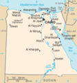
ચિત્ર:Eg-map.png
Eg-map.png (૩૨૭ × ૩૫૦ પીક્સલ, ફાઇલનું કદ: ૧૧ KB, MIME પ્રકાર: image/png)
ફાઇલનો ઇતિહાસ
તારીખ/સમય ઉપર ક્લિક કરવાથી તે સમયે ફાઇલ કેવી હતી તે જોવા મળશે.
| તારીખ/સમય | લઘુચિત્ર | પરિમાણો | સભ્ય | ટિપ્પણી | |
|---|---|---|---|---|---|
| વર્તમાન | ૦૦:૪૪, ૧૬ ફેબ્રુઆરી ૨૦૧૭ |  | ૩૨૭ × ૩૫૦ (૧૧ KB) | StevenJ81 | Reverted to version as of 19:51, 8 June 2010 (UTC): Perspective of map is from other side (see linked pages) |
| ૨૧:૦૯, ૧૪ જાન્યુઆરી ૨૦૧૭ |  | ૩૨૭ × ૩૫૦ (૨૭ KB) | عادل | Correction of Egyptian borders | |
| ૦૧:૨૧, ૯ જૂન ૨૦૧૦ |  | ૩૨૭ × ૩૫૦ (૧૧ KB) | Ras67 | cropped | |
| ૦૨:૦૨, ૪ માર્ચ ૨૦૦૫ |  | ૩૨૯ × ૩૫૨ (૧૨ KB) | Alfio | CIA map of Egypt |
ફાઇલનો વપરાશ
આ ફાઇલ માં નીચેનું પાનું વપરાયેલું છે:
ફાઇલનો વ્યાપક ઉપયોગ
નીચેની બીજી વિકિઓ આ ફાઈલ વાપરે છે:
- ar.wikipedia.org પર વપરાશ
- azb.wikipedia.org પર વપરાશ
- be-tarask.wikipedia.org પર વપરાશ
- bg.wikipedia.org પર વપરાશ
- bs.wiktionary.org પર વપરાશ
- ca.wikipedia.org પર વપરાશ
- da.wikipedia.org પર વપરાશ
- de.wikivoyage.org પર વપરાશ
- diq.wikipedia.org પર વપરાશ
- dsb.wikipedia.org પર વપરાશ
- el.wikipedia.org પર વપરાશ
- en.wikipedia.org પર વપરાશ
- es.wikipedia.org પર વપરાશ
- eu.wikipedia.org પર વપરાશ
- fiu-vro.wikipedia.org પર વપરાશ
- fi.wikipedia.org પર વપરાશ
- fr.wikipedia.org પર વપરાશ
- fr.wiktionary.org પર વપરાશ
- he.wikipedia.org પર વપરાશ
- hr.wikipedia.org પર વપરાશ
- id.wikipedia.org પર વપરાશ
- incubator.wikimedia.org પર વપરાશ
- io.wikipedia.org પર વપરાશ
- it.wikipedia.org પર વપરાશ
- it.wiktionary.org પર વપરાશ
- ja.wikipedia.org પર વપરાશ
- ja.wikinews.org પર વપરાશ
આ ફાઇલના વધુ વૈશ્વિક વપરાશ જુઓ.

