ચિત્ર:India Madhya Pradesh location map.svg

Size of this PNG preview of this SVG file: ૮૦૦ × ૫૬૩ પિક્સેલ. અન્ય આવર્તનો: ૩૨૦ × ૨૨૫ પિક્સેલ | ૬૪૦ × ૪૫૦ પિક્સેલ | ૧,૦૨૪ × ૭૨૦ પિક્સેલ | ૧,૨૮૦ × ૯૦૦ પિક્સેલ | ૨,૫૬૦ × ૧,૮૦૦ પિક્સેલ | ૧,૦૪૧ × ૭૩૨ પિક્સેલ.
મૂળભુત ફાઇલ (SVG ફાઇલ, માત્ર ૧,૦૪૧ × ૭૩૨ પીક્સલ, ફાઇલનું કદ: ૧૮૦ KB)
સારાંશ:
| વર્ણન |
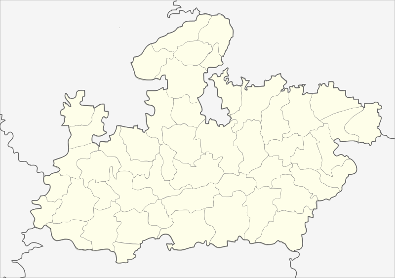
English: Locator map of Madhya Pradesh.
Geographical limits of the map:
Français : Carte de localisation du Madhya Pradesh, Inde. |
| તારીખ | (UTC) |
| સ્રોત | India_Madhya_Pradesh_locator_map.svg |
| લેખક |
India_Madhya_Pradesh_locator_map.svg: user:Planemad
|
| અન્ય આવૃત્તિઓ |
|


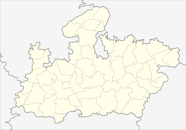
| This is a retouched picture, which means that it has been digitally altered from its original version. Modifications: Cropped map of madhya pradesh. The original can be viewed here: India Madhya Pradesh locator map.svg:
|
પરવાના
આ ફાઈલ વપરાશની પરવાનગી : Creative Commons Attribution-Share Alike 3.0 Unported license.
- તમે મુક્ત છો:
- વહેંચવા – નકલ કરવા, વિતરણ કરવા અને રચનાઓ મોકલવા
- રીમિક્સ કરવા કે મઠારવા – રચના અપનાવવા
- નીચેની શરત હેઠળ:
- આરોપણ – તમારે આ રચનાનો ઉપયોગ કરવા માટે લેખક કે પ્રકાશન અધિકાર ધારકની યોગ્ય માહિતી, પરવાનગી (લાયસન્સ)ની કડી અને તેમાં ફેરફાર કર્યો હોય તો તેનો ઉલ્લેખ કરવો જ પડશે. તમે આ સત્તા અનુસાર જ આ રચનાનો પ્રયોગ થવો જોઈએ, પણ તેઓ તમને અથવા તમારા ઉપયોગ સાથે સંમત થાય છે તે રીતે નહીં.
- શેર- અલાઈક (બિન ભેદભાવ વહેંચણી) – તમે જો આ રચનાને બદલશો, તેમાં ફેરફાર કરશો અથવા તેના પર આધારિત કોઇ કાર્ય બનાવશો તો તમારે પરિણામી કાર્યને તે જ અથવા અનુરૂપ પરવાનગી હેઠળ જ પ્રકાશિત કરવું પડશે.
અસલ - મૂળ અપલોડનો લોગ
This image is a derivative work of the following images:
- File:India_Madhya_Pradesh_locator_map.svg licensed with Cc-by-sa-3.0
- 2006-08-06T17:38:20Z Planemad 1639x1852 (768594 Bytes) {{WikiProject_India_Maps |Title=Madhya Pradesh locator map |Description=Locator map of the state of Madhya Pradesh, [[w:India|India]] with district boundaries. |Source=. |Date=August 6 2006 |Author=[[w:user:Nichalp]][[w:user
Uploaded with derivativeFX
| Annotations | This image is annotated: View the annotations at Commons |
ફાઇલનો ઇતિહાસ
તારીખ/સમય ઉપર ક્લિક કરવાથી તે સમયે ફાઇલ કેવી હતી તે જોવા મળશે.
| તારીખ/સમય | લઘુચિત્ર | પરિમાણો | સભ્ય | ટિપ્પણી | |
|---|---|---|---|---|---|
| વર્તમાન | ૦૩:૫૬, ૨૬ ફેબ્રુઆરી ૨૦૧૩ | | ૧,૦૪૧ × ૭૩૨ (૧૮૦ KB) | Milenioscuro | updated new districts, colors according german map workshop and the other India location maps |
| ૧૭:૪૯, ૨૫ નવેમ્બર ૨૦૧૦ |  | ૬૧૦ × ૪૪૦ (૧૪૬ KB) | Nayvik | Changed background color | |
| ૧૭:૪૩, ૨૫ નવેમ્બર ૨૦૧૦ |  | ૬૧૦ × ૪૪૦ (૧૪૬ KB) | Nayvik | {{Information |Description=Locator map of Madhya Pradesh.<br> Geographical limits of the map: * 28.0°N * 20.0°N * 84.0°E * 72.0°E |Source=*File:India_Madhya_Pradesh_locator_map.svg |Date=2010-11-25 12:11 (UTC) |Author=*[[:Fi |
ફાઇલનો વપરાશ
આ ફાઇલ માં 3 નીચેનાં પાનાઓ વપરાયેલાં છે:
ફાઇલનો વ્યાપક ઉપયોગ
નીચેની બીજી વિકિઓ આ ફાઈલ વાપરે છે:
- de.wikipedia.org પર વપરાશ
- de.wikivoyage.org પર વપરાશ
- en.wikipedia.org પર વપરાશ
- eo.wikipedia.org પર વપરાશ
- fa.wikipedia.org પર વપરાશ
આ ફાઇલના વધુ વૈશ્વિક વપરાશ જુઓ.