ચિત્ર:Heard Island.jpg

આ પૂર્વાવલોકનનું કદ: ૮૦૦ × ૪૧૩ પિક્સેલ. અન્ય આવર્તનો: ૩૨૦ × ૧૬૫ પિક્સેલ | ૬૪૦ × ૩૩૧ પિક્સેલ | ૧,૨૮૦ × ૬૬૧ પિક્સેલ.
મૂળભુત ફાઇલ (૧,૨૮૦ × ૬૬૧ પીક્સલ, ફાઇલનું કદ: ૬૦ KB, MIME પ્રકાર: image/jpeg)
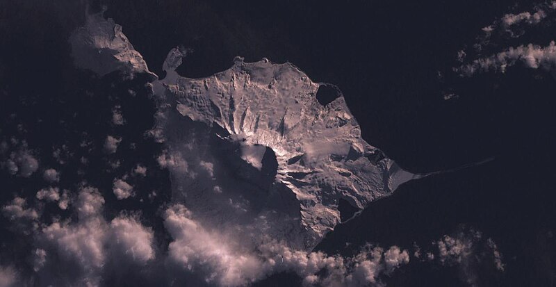
સારાંશ:
| વર્ણન |
English: Heard Island |
| તારીખ | ૩ ફેબ્રુઆરી ૨૦૦૫ (upload date) |
| સ્રોત | Satellite imagery taken by screenshot from NASA World Wind software |
| લેખક | NASA |
| Object location | | View this and other nearby images on: OpenStreetMap |
|---|
પરવાના
| This image is in the public domain because it is a screenshot from NASA’s globe software World Wind using a public domain layer, such as Blue Marble, MODIS, Landsat, SRTM, USGS or GLOBE.
|
 |
ફાઇલનો ઇતિહાસ
તારીખ/સમય ઉપર ક્લિક કરવાથી તે સમયે ફાઇલ કેવી હતી તે જોવા મળશે.
| તારીખ/સમય | લઘુચિત્ર | પરિમાણો | સભ્ય | ટિપ્પણી | |
|---|---|---|---|---|---|
| વર્તમાન | ૧૧:૧૦, ૩ ફેબ્રુઆરી ૨૦૦૫ | | ૧,૨૮૦ × ૬૬૧ (૬૦ KB) | Dysprosia~commonswiki | Heard Island, from NASA World Wind, {{PD-USGov-NASA}}, worldwind://goto/world=Earth&lat=-53.1084289550781&lon=73.5561141967773&view=0.609335660934448 |
ફાઇલનો વપરાશ
આ ફાઇલને કોઇ પાનાં વાપરતા નથી.
ફાઇલનો વ્યાપક ઉપયોગ
નીચેની બીજી વિકિઓ આ ફાઈલ વાપરે છે:
- af.wikipedia.org પર વપરાશ
- ar.wikipedia.org પર વપરાશ
- ast.wikipedia.org પર વપરાશ
- az.wikipedia.org પર વપરાશ
- be.wikipedia.org પર વપરાશ
- ca.wikipedia.org પર વપરાશ
- ceb.wikipedia.org પર વપરાશ
- ckb.wikipedia.org પર વપરાશ
- cs.wikipedia.org પર વપરાશ
- cy.wikipedia.org પર વપરાશ
- de.wikipedia.org પર વપરાશ
- de.wikivoyage.org પર વપરાશ
- en.wikipedia.org પર વપરાશ
- en.wikivoyage.org પર વપરાશ
- eo.wikipedia.org પર વપરાશ
- eo.wikinews.org પર વપરાશ
- es.wikipedia.org પર વપરાશ
- fa.wikipedia.org પર વપરાશ
- fi.wikipedia.org પર વપરાશ
- frr.wikipedia.org પર વપરાશ
- fr.wikipedia.org પર વપરાશ
- fr.wikivoyage.org પર વપરાશ
- fy.wikipedia.org પર વપરાશ
- gl.wikipedia.org પર વપરાશ
- he.wikipedia.org પર વપરાશ
- he.wikivoyage.org પર વપરાશ
- hr.wikipedia.org પર વપરાશ
- hu.wikipedia.org પર વપરાશ
- id.wikipedia.org પર વપરાશ
આ ફાઇલના વધુ વૈશ્વિક વપરાશ જુઓ.