ચિત્ર:LocationIndia.png

આ પૂર્વાવલોકનનું કદ: ૮૦૦ × ૩૭૦ પિક્સેલ. અન્ય આવર્તનો: ૩૨૦ × ૧૪૮ પિક્સેલ | ૬૪૦ × ૨૯૬ પિક્સેલ | ૧,૩૫૭ × ૬૨૮ પિક્સેલ.
મૂળભુત ફાઇલ (૧,૩૫૭ × ૬૨૮ પીક્સલ, ફાઇલનું કદ: ૨૧ KB, MIME પ્રકાર: image/png)

|
This locator map image could be re-created using vector graphics as an SVG file. This has several advantages; see Commons:Media for cleanup for more information. If an SVG form of this image is available, please upload it and afterwards replace this template with
{{vector version available|new image name}}.
It is recommended to name the SVG file “LocationIndia.svg”—then the template Vector version available (or Vva) does not need the new image name parameter. |
સારાંશ:
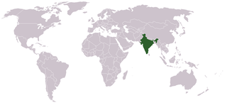
Location map for w:India.
User:dbenbenn modified Image:BlankMap-World.png.
પરવાના
| |
આ રચના ના લેખક Vardion, at the અંગ્રેજી વિકિપીડિયા project દ્વારા આ રચનાને public domain હેઠળ પ્રકાશિત કરાઈ છે. આ સવલત વિશ્વવ્યપી છે In case this is not legally possible: |
ફાઇલનો ઇતિહાસ
તારીખ/સમય ઉપર ક્લિક કરવાથી તે સમયે ફાઇલ કેવી હતી તે જોવા મળશે.
| તારીખ/સમય | લઘુચિત્ર | પરિમાણો | સભ્ય | ટિપ્પણી | |
|---|---|---|---|---|---|
| વર્તમાન | ૧૩:૦૫, ૧૧ સપ્ટેમ્બર ૨૦૨૧ | | ૧,૩૫૭ × ૬૨૮ (૨૧ KB) | Ytpks896 | Reverted to version as of 22:39, 12 February 2005 (UTC) |
| ૧૯:૦૭, ૨૯ જુલાઇ ૨૦૨૧ |  | ૧,૪૨૭ × ૬૨૮ (૧૦૩ KB) | Ytpks896 | Reverted to version as of 03:16, 1 May 2008 (UTC) | |
| ૦૬:૦૩, ૧૫ ફેબ્રુઆરી ૨૦૧૦ |  | ૧,૩૫૭ × ૬૨૮ (૨૪ KB) | King Zebu | Reverted to version as of 09:17, 3 June 2005 Please discuss before making such edits in future. | |
| ૦૮:૪૬, ૧ મે ૨૦૦૮ |  | ૧,૪૨૭ × ૬૨૮ (૧૦૩ KB) | KAVO | (Changed to colours more noticeable: *Light green - Claimed by India, not administered by India **(Aksai Chin, Azad Kashmir, Northern Areas, Shaksgam Valley) *Deep Green - Disputed with other nations, administered by India **(Arunachal Pradesh, Jammu and | |
| ૧૪:૪૭, ૩ જૂન ૨૦૦૫ |  | ૧,૩૫૭ × ૬૨૮ (૨૪ KB) | Nichalp | NPOV map, please discuss any changes with me for NPOV status | |
| ૦૪:૦૯, ૧૩ ફેબ્રુઆરી ૨૦૦૫ |  | ૧,૩૫૭ × ૬૨૮ (૨૧ KB) | Dbenbenn | higher resolution version, without black border | |
| ૦૧:૫૮, ૬ ડિસેમ્બર ૨૦૦૪ |  | ૨૫૦ × ૧૧૫ (૧૮ KB) | EugeneZelenko | Location map for India.<br/>Originally created for English Wikipedia by Vardion.<br/>{{GFDL}} |
ફાઇલનો વપરાશ
આ ફાઇલને કોઇ પાનાં વાપરતા નથી.
ફાઇલનો વ્યાપક ઉપયોગ
નીચેની બીજી વિકિઓ આ ફાઈલ વાપરે છે:
- ar.wikinews.org પર વપરાશ
- ckb.wikipedia.org પર વપરાશ
- en.wikipedia.org પર વપરાશ
- en.wikinews.org પર વપરાશ
- en.wikivoyage.org પર વપરાશ
- en.wiktionary.org પર વપરાશ
- fr.wikinews.org પર વપરાશ
- fur.wikipedia.org પર વપરાશ
- he.wikivoyage.org પર વપરાશ
- hr.wikipedia.org પર વપરાશ
- hr.wikiquote.org પર વપરાશ
- incubator.wikimedia.org પર વપરાશ
- ko.wikipedia.org પર વપરાશ
- li.wikinews.org પર વપરાશ
- pam.wikipedia.org પર વપરાશ
- pl.wiktionary.org પર વપરાશ
- ps.wikivoyage.org પર વપરાશ
- pt.wikivoyage.org પર વપરાશ
- pt.wiktionary.org પર વપરાશ
- sr.wikibooks.org પર વપરાશ
- sv.wikinews.org પર વપરાશ
આ ફાઇલના વધુ વૈશ્વિક વપરાશ જુઓ.