ચિત્ર:Papal States 1789.svg

Size of this PNG preview of this SVG file: ૪૫૦ × ૪૫૬ પિક્સેલ. અન્ય આવર્તનો: ૨૩૭ × ૨૪૦ પિક્સેલ | ૪૭૪ × ૪૮૦ પિક્સેલ | ૭૫૮ × ૭૬૮ પિક્સેલ | ૧,૦૧૧ × ૧,૦૨૪ પિક્સેલ | ૨,૦૨૧ × ૨,૦૪૮ પિક્સેલ.
મૂળભુત ફાઇલ (SVG ફાઇલ, માત્ર ૪૫૦ × ૪૫૬ પીક્સલ, ફાઇલનું કદ: ૭૯૯ KB)
સારાંશ:


.svg)
.svg)
.svg)
.svg)
.svg)


.svg)
.svg)
.svg)


.png)
.png)


.svg)


.svg)

.svg)


.svg)
.svg)
.svg)
.svg)


.svg)
.png)


.svg)


.svg)
.svg)


.svg)


.svg)


.svg)
.svg)
.svg)
.svg)
.svg)
.svg)
.svg)
_cropped.svg)
.svg)
.svg)
.svg)
.svg)
.svg)
.svg)
.svg)
.svg)
.svg)
.svg)
.svg)
.svg)
.svg)
.svg)
.svg)
.svg)
.svg)
.svg)
.svg)
.svg)
.svg)
.svg)
.svg)
.svg)
.svg)
.svg)
.svg)
.svg)
.svg)
.svg)
.svg)
.svg)
.svg)
.svg)
.svg)
.svg)
.svg)
.svg)
.svg)
.svg)
.svg)
.svg)
.svg)
.svg)
.svg)
પરવાના
હું, આ કાર્યનો પ્રકાશનાધિકાર ધારક, તેને નીચેના પરવાના હેઠળ અહીં પ્રકાશીત કરૂં છું:
આ ફાઈલ વપરાશની પરવાનગી : Creative Commons Attribution-Share Alike 3.0 Unported license.
- તમે મુક્ત છો:
- વહેંચવા – નકલ કરવા, વિતરણ કરવા અને રચનાઓ મોકલવા
- રીમિક્સ કરવા કે મઠારવા – રચના અપનાવવા
- નીચેની શરત હેઠળ:
- આરોપણ – તમારે આ રચનાનો ઉપયોગ કરવા માટે લેખક કે પ્રકાશન અધિકાર ધારકની યોગ્ય માહિતી, પરવાનગી (લાયસન્સ)ની કડી અને તેમાં ફેરફાર કર્યો હોય તો તેનો ઉલ્લેખ કરવો જ પડશે. તમે આ સત્તા અનુસાર જ આ રચનાનો પ્રયોગ થવો જોઈએ, પણ તેઓ તમને અથવા તમારા ઉપયોગ સાથે સંમત થાય છે તે રીતે નહીં.
- શેર- અલાઈક (બિન ભેદભાવ વહેંચણી) – તમે જો આ રચનાને બદલશો, તેમાં ફેરફાર કરશો અથવા તેના પર આધારિત કોઇ કાર્ય બનાવશો તો તમારે પરિણામી કાર્યને તે જ અથવા અનુરૂપ પરવાનગી હેઠળ જ પ્રકાશિત કરવું પડશે.
અસલ - મૂળ અપલોડનો લોગ
This image is a derivative work of the following images:
- File:Europe_1789.svg licensed with Cc-by-sa-3.0
- 2013-04-14T03:44:26Z Alphathon 450x456 (858577 Bytes) Corrected some errors in northern Italy
- 2013-04-14T01:38:01Z Alphathon 450x456 (853881 Bytes) tweaked again
- 2013-04-14T01:36:10Z Alphathon 450x456 (853881 Bytes) Tweaked Holy Roman Empire border style
- 2013-04-14T01:33:26Z Alphathon 450x456 (853857 Bytes) == {{int:filedesc}} == {{Information |Description={{en|A blank Map of Europe circa 1789. This map also includes a border for the [[:en:Holy Roman Empire|Holy Roman Empire]]. Since there are so many small German states, they h
Uploaded with derivativeFX
ફાઇલનો ઇતિહાસ
તારીખ/સમય ઉપર ક્લિક કરવાથી તે સમયે ફાઇલ કેવી હતી તે જોવા મળશે.
| તારીખ/સમય | લઘુચિત્ર | પરિમાણો | સભ્ય | ટિપ્પણી | |
|---|---|---|---|---|---|
| વર્તમાન | ૧૩:૨૮, ૧૭ ઓક્ટોબર ૨૦૨૧ | | ૪૫૦ × ૪૫૬ (૭૯૯ KB) | Fenn-O-maniC | Fixed the Russo-Swedish border to match the Treaty of Åbo of 1743 |
| ૨૧:૫૯, ૧૮ એપ્રિલ ૨૦૧૩ |  | ૪૫૦ × ૪૫૬ (૮૨૦ KB) | Alphathon | Various fixes (see blank version) | |
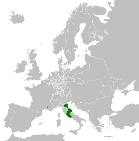
| ૦૯:૩૦, ૧૪ એપ્રિલ ૨૦૧૩ |  | ૪૫૦ × ૪૫૬ (૮૦૨ KB) | Alphathon | == {{int:filedesc}} == {{Information |Description={{en|A map the Papal States circa 1789.}}{{de|Eine Landkarte die Kirchenstaat c. 1989.}} |Source={{Derived from|Europe_1789.svg|display=50}} |Date=2013-04-14 03... |
ફાઇલનો વપરાશ
આ ફાઇલને કોઇ પાનાં વાપરતા નથી.
ફાઇલનો વ્યાપક ઉપયોગ
નીચેની બીજી વિકિઓ આ ફાઈલ વાપરે છે:
- arz.wikipedia.org પર વપરાશ
- ast.wikipedia.org પર વપરાશ
- cdo.wikipedia.org પર વપરાશ
- cs.wikipedia.org પર વપરાશ
- en.wikipedia.org પર વપરાશ
- fr.wikipedia.org પર વપરાશ
- ga.wikipedia.org પર વપરાશ
- gl.wikipedia.org પર વપરાશ
- he.wikipedia.org પર વપરાશ
- hr.wikipedia.org પર વપરાશ
- ja.wikipedia.org પર વપરાશ
- ka.wikipedia.org પર વપરાશ
- ko.wikipedia.org પર વપરાશ
- mk.wikipedia.org પર વપરાશ
- oc.wikipedia.org પર વપરાશ
- sq.wikipedia.org પર વપરાશ
- tg.wikipedia.org પર વપરાશ
- ur.wikipedia.org પર વપરાશ
- www.wikidata.org પર વપરાશ
- xmf.wikipedia.org પર વપરાશ
- zh-min-nan.wikipedia.org પર વપરાશ
- zh.wikipedia.org પર વપરાશ