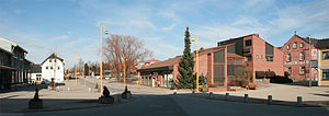
Løten Municipality
municipality in Innlandet, Norway
ઉદાહરણ
municipality of Norway
સ્થાપન દિવસ / રચના દિવસ
1838
દેશ
રાજધાની
Løten
પ્રશાસન વિભાગમાં આવેલ છે
Innlandet
શરૂઆતની તારીખ: ૧ જાન્યુઆરી 2020
સમય વિભાગ
UTC+01:00
સ્થળના અક્ષાંસ રેખાંશ
સૌથી ઉચું સ્થળ
કાર્યાલયમાં સરકારના પ્રમુખ
Mayor of Løten
સરકારના વડા
વસ્તી / જનસંખ્યા
સરહદ દ્વારા જોડાયેલ
Hamar Municipality
Åmot Municipality
Elverum Municipality
Våler Municipality
Stange Municipality
સત્તાવાર / માન્યતા પ્રાપ્ત ભાષાઓ
Bokmål
સમય બિંદુ: ૧ ઓક્ટોબર 2015
object of statement has role: målform
ક્ષેત્રફળ
અધિકૃત વેબસાઇટ
https://www.loten.kommune.no/
ભાષા: Bokmål
ઘરોની સંખ્યા
has list
Q11972841
કોમન્સ શ્રેણી
Løten
વિષયની મુખ્ય શ્રેણી
Category:Løten
અહીં જન્મેલા લોકોની શ્રેણી
Q24806251
category for maps or plans
Category:Maps of Løten
સંદર્ભ
- ↑ Freebase Data Dumps, ૨૮ ઓક્ટોબર 2013
- ↑ GeoNames
- ↑ MusicBrainz
- ↑ iNaturalist, ૨૫ એપ્રિલ 2021, https://www.inaturalist.org/places/inaturalist-places.csv.zip
- ↑ ૫.૦ ૫.૧ ૯ માર્ચ 2018, http://www.sprakradet.no/sprakhjelp/Skriverad/navn-pa-steder-og-personer/Innbyggjarnamn/
- ↑ ૧૨ માર્ચ 2021, https://kartverket.no/til-lands/fakta-om-norge/hoyeste-fjelltopp-i-kommunen
- ↑ Ny ordfører og nytt kommunestyre i Løten, https://www.loten.kommune.no/article47362-833.html
- ↑ https://www.ssb.no/statbank/table/07459/, ૨૧ ફેબ્રુઆરી 2023, Statistics Norway, Alders- og kjønnsfordeling i kommuner, fylker og hele landets befolkning (K) 1986 - 2023
- ↑ https://www.ssb.no/statbank/table/07459/, ૨૧ ફેબ્રુઆરી 2023, Statistics Norway, 07459: Alders- og kjønnsfordeling i kommuner, fylker og hele landets befolkning (K) 1986 - 2023
- ↑ Area statistics for Norway 2020
- ↑ Housing conditions for Norway 2018


