ચિત્ર:Krim 2014 de.svg

Size of this PNG preview of this SVG file: ૬૬૫ × ૪૪૧ પિક્સેલ. અન્ય આવર્તનો: ૩૨૦ × ૨૧૨ પિક્સેલ | ૬૪૦ × ૪૨૪ પિક્સેલ | ૧,૦૨૪ × ૬૭૯ પિક્સેલ | ૧,૨૮૦ × ૮૪૯ પિક્સેલ | ૨,૫૬૦ × ૧,૬૯૮ પિક્સેલ.
મૂળભુત ફાઇલ (SVG ફાઇલ, માત્ર ૬૬૫ × ૪૪૧ પીક્સલ, ફાઇલનું કદ: ૧૦૩ KB)
સારાંશ:
| વર્ણન |
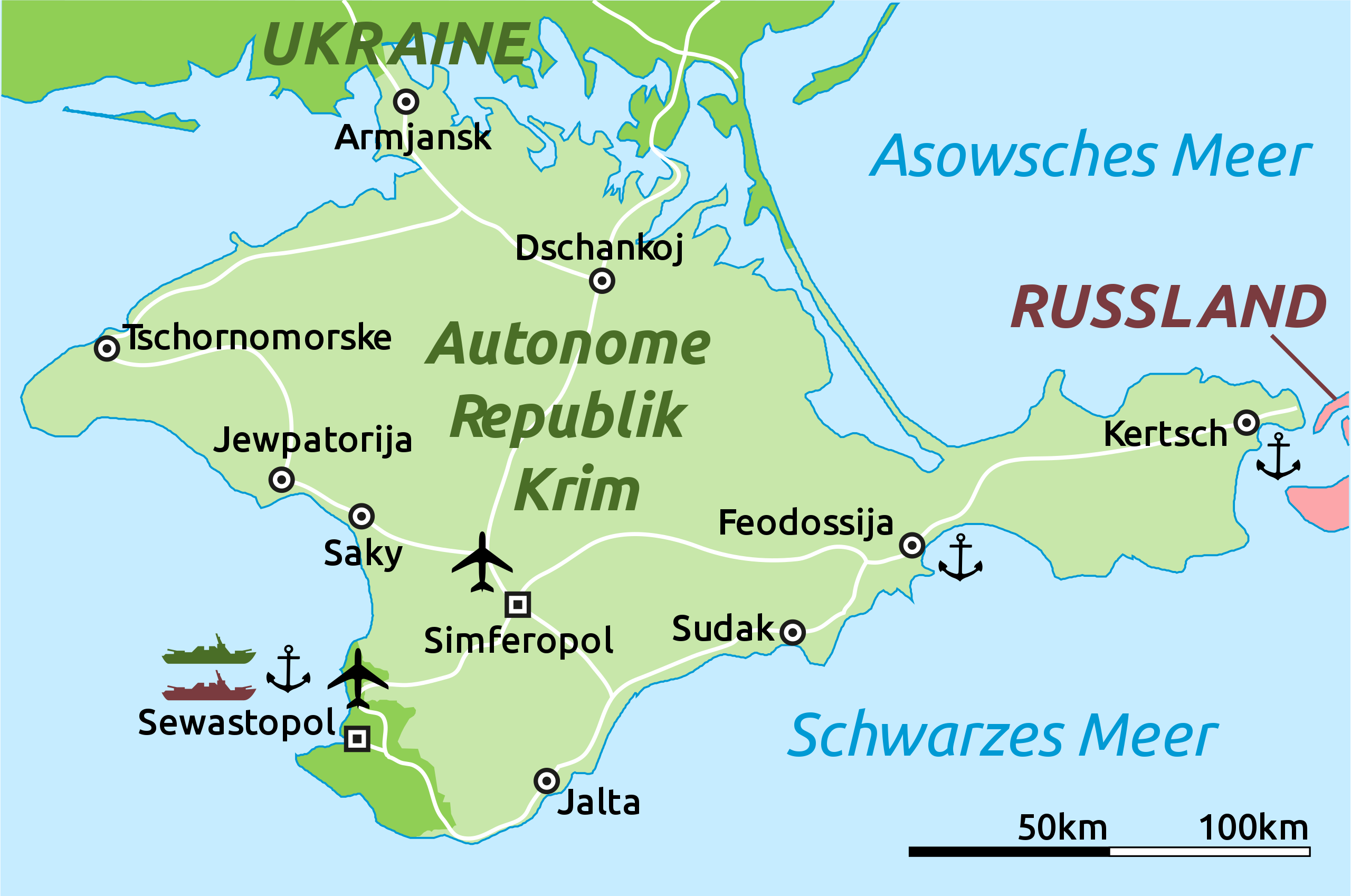
Deutsch: Karte der Krim-Republik.
English: Map of the Autonomous Republic of Crimea and of Sevastopol, Ukraine. |
| તારીખ | |
| સ્રોત |
This file was derived from : |
| લેખક |
Original: Vector: Furfur અને Martin Kraft |
| અન્ય આવૃત્તિઓ |
|
| SVG genesis | This locator map was created with Adobe Illustrator. |

પરવાના
હું, આ કાર્યનો પ્રકાશનાધિકાર ધારક, તેને નીચેના પરવાના હેઠળ અહીં પ્રકાશીત કરૂં છું:
| આ ફાઈલ વપરાશની પરવાનગી : Creative Commons CC0 1.0 Universal Public Domain Dedication. | |
| આ રચના સાથે સંકળાયેલી વ્યક્તિએ આ રચનાના સર્વ વૈશ્વીક પ્રકાશન અધિકારોને દસ્તાવેજ (deed) દ્વારપબ્લીક ડોમેન public domainમાં અર્પિત કર્યાં છે. તમે આની નકલ કરી શકો, વહેંચી શકો, ધંધાદારી કારનો માટે પણ. આ માટે કોઈ પણ પરવાનગી લેવાની જરૂર નથી
|
અસલ - મૂળ અપલોડનો લોગ
This image is a derivative work of the following images:
- Crimea republic map.png licensed with Cc-zero
- 2012-09-06T09:53:36Z PANONIAN 1031x684 (62218 Bytes) corrected Sevastopol border
- 2012-08-30T11:55:15Z PANONIAN 1031x684 (61885 Bytes) {{Information |Description=Map of the Autonomous Republic Crimea, Ukraine. |Source={{own}} |Date=2012 |Author= [[User:PANONIAN|PANONIAN]] |Permission= |other_versions= }}
Uploaded with derivativeFX
ફાઇલનો ઇતિહાસ
તારીખ/સમય ઉપર ક્લિક કરવાથી તે સમયે ફાઇલ કેવી હતી તે જોવા મળશે.
| તારીખ/સમય | લઘુચિત્ર | પરિમાણો | સભ્ય | ટિપ્પણી | |
|---|---|---|---|---|---|
| વર્તમાન | ૨૨:૨૨, ૫ માર્ચ ૨૦૧૪ | | ૬૬૫ × ૪૪૧ (૧૦૩ KB) | Schwarzorange | moved "Saky" closer to Saky |
| ૦૦:૪૦, ૫ માર્ચ ૨૦૧૪ |  | ૬૬૫ × ૪૪૧ (૧૦૩ KB) | Martin Kraft | Maßstab, +Tschornomorske, diverse kleiner Optimierungen | |
| ૧૬:૦૭, ૪ માર્ચ ૨૦૧૪ |  | ૬૬૫ × ૪૪૧ (૧૦૩ KB) | Martin Kraft | Dzhankoi -> Dschankoj | |
| ૧૬:૫૫, ૩ માર્ચ ૨૦૧૪ |  | ૬૬૫ × ૪૪૧ (૧૦૩ KB) | Martin Kraft | Straßen, weiter Städte, Farben | |
| ૧૪:૦૯, ૩ માર્ચ ૨૦૧૪ |  | ૬૬૫ × ૪૪૧ (૧૦૫ KB) | Martin Kraft | Pfade aufgeräumt. Dateigröße halbiert. | |
| ૧૩:૧૨, ૩ માર્ચ ૨૦૧૪ |  | ૬૬૫ × ૪૪૧ (૨૨૯ KB) | Furfur | Sinferopol -> Simferopol | |
| ૦૪:૦૯, ૩ માર્ચ ૨૦૧૪ |  | ૬૬૫ × ૪૪૧ (૨૨૫ KB) | Martin Kraft | +Flughafen | |
| ૦૩:૫૭, ૩ માર્ચ ૨૦૧૪ |  | ૬૬૫ × ૪૪૧ (૨૨૬ KB) | Martin Kraft | Ohne Schraffur ist doch irgendwie besser | |
| ૦૩:૪૪, ૩ માર્ચ ૨૦૧૪ |  | ૬૬૫ × ૪૪૧ (૨૩૦ KB) | Martin Kraft | Karte komplett überarbeitet. Bei Nichtgefallen einfach revertieren, dann stelle ich sie seperat ein | |
| ૦૨:૧૪, ૩ માર્ચ ૨૦૧૪ |  | ૬૬૫ × ૪૪૧ (૩૧૩ KB) | Furfur | verbessert |
ફાઇલનો વપરાશ
આ ફાઇલને કોઇ પાનાં વાપરતા નથી.
ફાઇલનો વ્યાપક ઉપયોગ
નીચેની બીજી વિકિઓ આ ફાઈલ વાપરે છે:
- de.wikipedia.org પર વપરાશ
- fr.wikipedia.org પર વપરાશ
- sr.wikinews.org પર વપરાશ