ચિત્ર:Kathiawar map.jpg
આ પૂર્વાવલોકનનું કદ: ૮૦૦ × ૫૪૮ પિક્સેલ. અન્ય આવર્તનો: ૩૨૦ × ૨૧૯ પિક્સેલ | ૬૪૦ × ૪૩૮ પિક્સેલ | ૧,૦૨૪ × ૭૦૧ પિક્સેલ | ૧,૨૮૦ × ૮૭૭ પિક્સેલ | ૨,૪૯૨ × ૧,૭૦૭ પિક્સેલ.
મૂળભુત ફાઇલ (૨,૪૯૨ × ૧,૭૦૭ પીક્સલ, ફાઇલનું કદ: ૨.૮૭ MB, MIME પ્રકાર: image/jpeg)
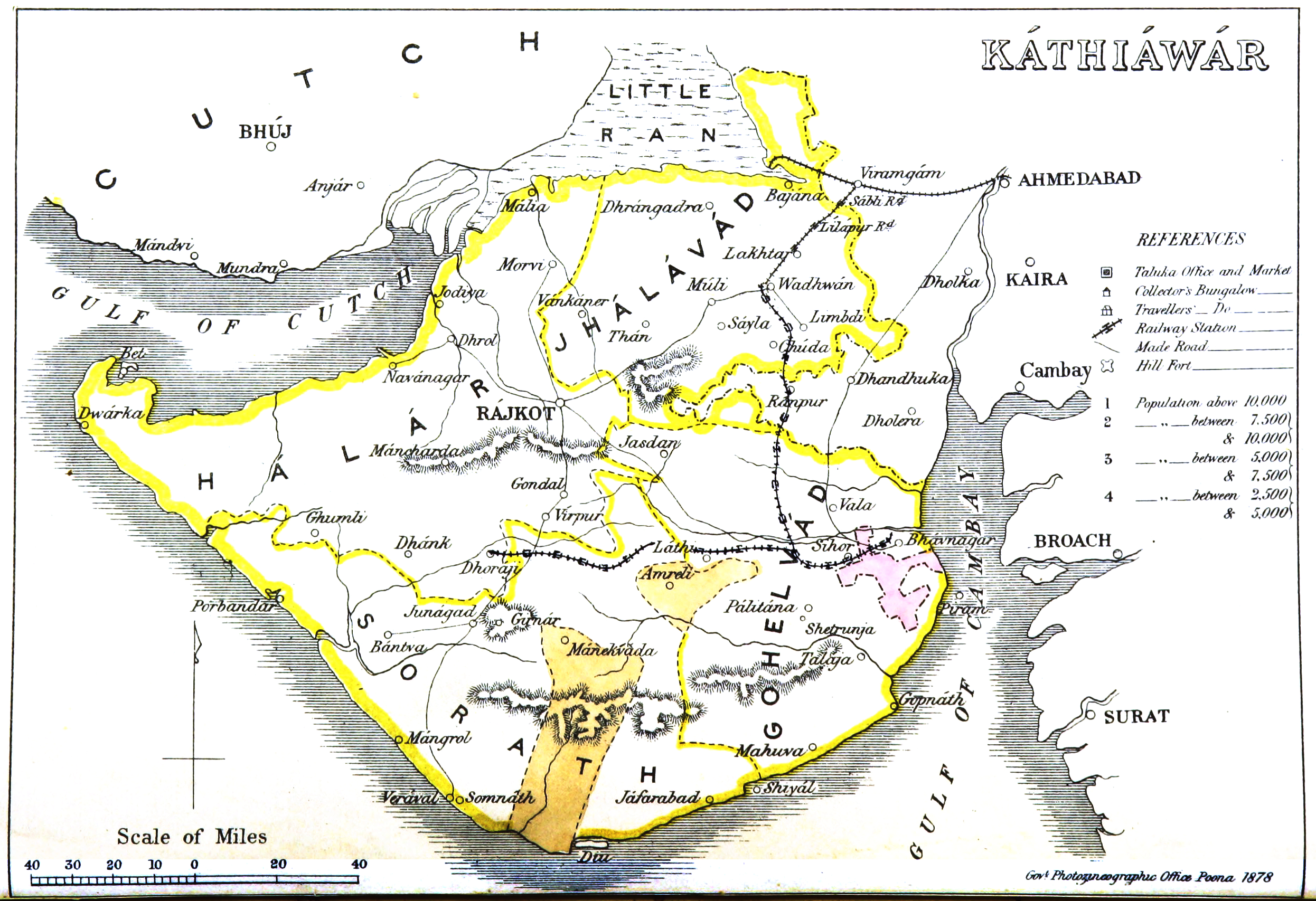
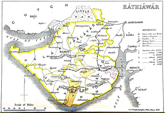
સારાંશ:
| Description |
English: Map of Kathiawar |
|||||||||
| તારીખ | ||||||||||
| સ્રોત | Gazetteer of the Bombay Presidency. (1896) by James M. Campbell | |||||||||
| રચયિતા |
Various |
|||||||||
| Geotemporal data | ||||||||||
| Bounding box |
|
|||||||||
| Georeferencing | ||||||||||
પરવાના
|
This work is in the public domain in its country of origin and other countries and areas where the copyright term is the author's life plus 70 years or fewer. This work is in the public domain in the United States because it was published (or registered with the U.S. Copyright Office) before January 1, 1929. | |
| પ્રકાશન કાયદા હેઠળ અને તેને મળતા આવતાં આ ફાઈલ ને મુક્ત ગણાઈ છે | |
ફાઇલનો ઇતિહાસ
તારીખ/સમય ઉપર ક્લિક કરવાથી તે સમયે ફાઇલ કેવી હતી તે જોવા મળશે.
| તારીખ/સમય | લઘુચિત્ર | પરિમાણો | સભ્ય | ટિપ્પણી | |
|---|---|---|---|---|---|
| વર્તમાન | ૨૦:૪૯, ૫ નવેમ્બર ૨૦૧૪ | | ૨,૪૯૨ × ૧,૭૦૭ (૨.૮૭ MB) | Shyamal | User created page with UploadWizard |
ફાઇલનો વપરાશ
આ ફાઇલ માં 4 નીચેનાં પાનાઓ વપરાયેલાં છે:
ફાઇલનો વ્યાપક ઉપયોગ
નીચેની બીજી વિકિઓ આ ફાઈલ વાપરે છે:
- bn.wikipedia.org પર વપરાશ
- ca.wikipedia.org પર વપરાશ
- de.wikipedia.org પર વપરાશ
- en.wikipedia.org પર વપરાશ
- kn.wikipedia.org પર વપરાશ
- ta.wikipedia.org પર વપરાશ
- ur.wikipedia.org પર વપરાશ
- www.wikidata.org પર વપરાશ